
As anticipated, most of Central New York received a mixture of sunshine and clouds alongside seasonable temperatures and some pop-up scattered showers, localized downpours and even a bit of lightning and thunder in the heaviest activity.
You can track the rain with Live Triple Doppler Radar and its one-hour loop here.
You can also take a look at the Interactive Doppler Radar here.
Most of the scattered showers, localized downpours and even a thunderstorm with small hail will leave most of our area by 8:00 PM. Thereafter, I cannot rule out a random passing isolated shower or downpour Thursday night. However, it appears that most of the activity will be very limited. The best chance for showers and extra lake effect clouds would be north of Route 31 late at night through Friday morning.
It should be noted that there should be at least partial clearing or even in spots mostly clear skies Thursday night.
A geomagnetic storm has created the potential for to the see the Northern Lights locally. However, conditions will not be as good as it will be across southern Canada.
What is a geomagnetic storm?:
–Geomagnetic storms are disturbances in Earth’s magnetic field that can result in many hours of vibrant auroras.
–The largest storms that result from these conditions are associated with solar coronal mass ejections (CMEs) where a billion tons or so of plasma from the sun, with its embedded magnetic field, arrives at Earth.
This sounds complicated!:
—Here is an easier explanation from NASA!
Will our area be able to see the northern lights Thursday night?:
–I do expect there to at least be some partial clearing tonight.
–The best chance to see the northern lights will be over the darkest parts of our area.
–City and street lamp lights will make this viewing much harder.
–Looking northward from the south shore of Lake Ontario and Oneida Lake may make viewing easier.
–The further northward you are in our area, the better the chance to view the aurora borealis!
–Using dark mode on your camera will help you be able to capture this much better!
–As mentioned above, the setup is not perfect for Central New York. So, it is not a slam dunk that our area will be able to see the Aurora Borealis.
Here is the overall forecast for the Northern Lights:

If you see the northern lights, make sure to send us any pictures or videos with Chime In here!
Let’s see what’s next beyond Thursday night:
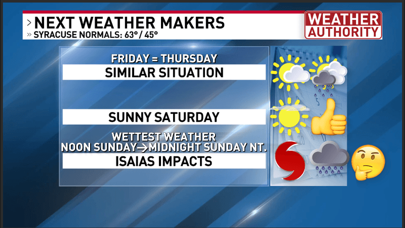
Central New York’s next weather makers
After a chilly and potentially frosty start to Saturday at dawn, especially for the coldest countryside. Otherwise, if you want to spend some time outdoors and not have to worry about any rain, I will definitely choose Saturday over Sunday!
Expect sunny skies Saturday with a thin veil of high clouds alongside an afternoon high in the middle to perhaps upper 60s. Saturday night should feature increasing high clouds but should remain dry right through sunrise.
As mentioned above, it still looks likely that we will receive a period of steadier rain from the leftovers of Isaias. We should not receive any gusty winds from this system. However, periods of heavier rain will be possible.
The best chance for the wettest weather locally will be roughly between Noon Sunday and Midnight Sunday night. Right now, it looks like many parts of Central New York will have risk of 0.75 to 1.25″ of rain from this system.
For more specifics about your forecast, watch my video below:
Video forecast from NBC3 News Live at 5:00 PM Thursday October 8th, 2026